Modern ecological disaster mitigation relies heavily on capital-intensive mechanical suppression, yet wildfire propagation physics dictate that reactive intervention yields diminishing marginal returns once fuel loads cross critical thresholds. The structural failure of standard fire management models stems from an over-reliance on suppression rather than continuous fuel reduction. Resolving this operational inefficiency requires analyzing how traditional Indigenous fire management principles intersect with modern geospatial architectures.
By deconstructing the mechanics of fuel accumulation, carbon accounting metrics, and spatial modeling, agencies can transition from high-fatality emergency response loops to predictive ecological maintenance. If you found value in this article, you might want to check out: this related article.
The Fuel Load Accumulation Problem
Wildfire intensity is a direct function of available dry biomass, atmospheric moisture, and wind velocity, expressed through the Byram fire intensity formula. When suppression policies remove low-intensity fire from an ecosystem for decades, dead organic matter, dense understory shrubs, and ladder fuels accumulate exponentially.
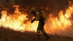
This creates a high-energy fuel bed where subsequent ignitions transition rapidly from surface fires into crown fires. Traditional land stewardship avoided this state through high-frequency, low-intensity applications of fire, historically termed cool burning or firestick farming. For another perspective on this development, refer to the recent coverage from Mashable.
The operational divergence between colonial suppression models and Indigenous practices rests on a fundamental misunderstanding of temporal frequency. Modern agencies often treat fire as an emergency anomaly to be extinguished immediately. Indigenous management treats fire as a high-frequency, low-magnitude maintenance variable.
When fire intervals are extended beyond the ecological threshold of the understory, the absolute energy release per hectare during a wildfire event scales non-linearly. The cost function of suppression rises concurrently, exhausting fiscal budgets and increasing ecological destruction.
Integrating Geospatial Remote Sensing with Traditional Stewardship
Optimizing modern fire regimes requires mapping fine-scale fuel arrays across millions of hectares of remote terrain. Satellite-based remote sensing, utilizing multispectral imagery from Sentinel and Landsat platforms, provides continuous tracking of vegetation health, moisture stress, and biomass accumulation.
Machine learning algorithms ingest these raster datasets alongside meteorological variables to predict high-risk ignition zones weeks in advance.
However, algorithmic predictions lack contextual on-ground parameters such as micro-topography, wind behavior channeled by specific valley formations, and localized cultural site sensitivities.
To bridge this data deficit, operations couple predictive machine learning outputs with traditional ecological knowledge held by Indigenous rangers. Indigenous landholders possess fine-grained observations of seasonal indicators, including wind shifts, insect activity, and plant flowering cycles, which dictate optimal ignition windows.
The integration mechanism functions through spatial decision support systems. Geospatial software ingests satellite burn scar mapping and fuel moisture indices, outputting tactical maps that guide Indigenous rangers on where to execute precise, low-intensity mosaic burns. This pairing transforms raw satellite telemetry into actionable, localized ground operations.
Economic Incentives and Carbon Accounting Mechanisms
The scalability of combined technological and traditional fire management is financially underpinned by structured carbon credit markets, specifically frameworks like Australia's Australian Carbon Credit Unit (ACCU) Scheme. Uncontrolled late dry-season wildfires in tropical and arid savannas release massive volumes of methane and nitrous oxide into the atmosphere.
By executing planned early dry-season fires, land managers reduce the total area burned by high-intensity late-season wildfires, resulting in net greenhouse gas abatement.
The economic mechanics operate through rigorous baseline modeling:
- Baseline Emissions Calculation: Historical satellite records establish the average carbon loss from uncontrolled fires over a rolling multi-year period.
- Abatement Verification: Post-burn multispectral imaging calculates the precise surface area treated and the reduction in high-intensity combustion.
- Credit Issuance: Verified emissions reductions generate tradeable carbon credits, providing sustained revenue streams directly to Indigenous corporations managing the land.
This financial feedback loop resolves the traditional funding deficit inherent in conservation work. Indigenous carbon businesses currently account for a dominant share of carbon credits generated through savanna fire methods, turning ecological stewardship into a self-funding enterprise.
The primary operational constraint lies in the transferability of these savanna methods to temperate ecosystems. While tropical and arid grasslands respond predictably to early dry-season mosaic burns, temperate forests feature complex multi-layered canopies and variable moisture regimes that complicate standardized carbon accounting and ignition protocols.
Operational Bottlenecks in Contemporary Scaling
Translating dual-knowledge fire strategies across diverse geographical jurisdictions encounters distinct institutional friction points. Regulatory frameworks governing prescribed burns often demand rigid liability assumptions, bureaucratic permitting windows, and inflexible operational calendars that conflict with the real-time, weather-dependent nature of traditional burning.
If an agency mandates a fixed date for a controlled burn based on administrative scheduling rather than atmospheric humidity and wind vectors, the operation risks escaping control or failing to achieve desired fuel reduction metrics.
Furthermore, data interoperability remains an internal challenge. Modern GIS databases and traditional oral ecological records utilize entirely different epistemological structures. Translating qualitative, generational observations of Country into vector layers or relational databases requires structured ontological mapping.
Without dedicated boundary organizations to translate between Indigenous landholders and remote-sensing data scientists, communication bottlenecks emerge, slowing down deployment during critical seasonal transition windows.
Deploy regional operational nodes that embed geospatial data analysts directly within Indigenous ranger organizations, bypassing central bureaucratic approval delays to execute tactical burns during optimal meteorological windows.