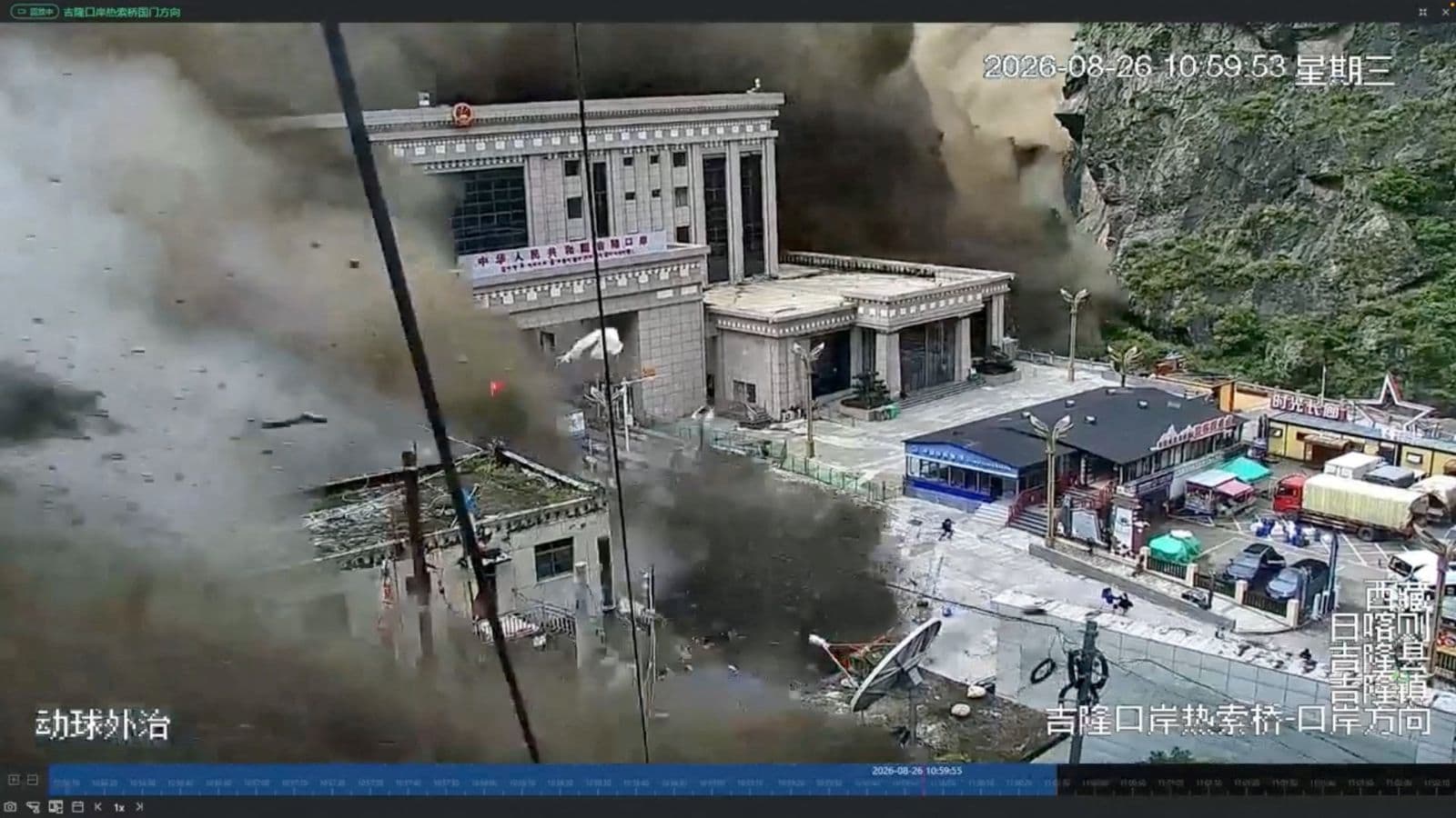
A towering wall of sludge and stone swallows a fortified immigration outpost in mere seconds. That single piece of surveillance footage changed everything we knew about the disaster unfolding in the Himalayas.
When the August 26 flash floods slammed the Tibet-Nepal border, initial reports only trickled out from the Nepalese side. Entire settlements along the Trishuli River transformed into grey wastelands overnight. But the release of high-definition surveillance clips and satellite imagery from Gyirong Port provided a stark, terrifying look at the sheer velocity of high-altitude climate catastrophes.
Why the Geological Trigger Surprised Scientists
Earth scientists reviewing satellite data quickly realized this wasn't your run-of-the-mill monsoon overflow. A massive section of bedrock beneath the Langtang Lirung peak glacier sheared away entirely, dragging millions of tons of ice and rock down the steep mountain valleys.
The impact registered on seismic monitors as a 5.2 magnitude event. It wasn't an earthquake, though. It was a mountain collapsing under its own weight, supercharged by melting glacial ice that turned the descending avalanche into a liquid battering ram.
The water didn't just rise; it charged. Rivers like the Lhende Khola and Bhotekoshi instantly swelled, carrying pulverized rock straight into narrow gorges and densely populated trade routes.
The Human Toll and the Search for Answers
The visual evidence matches a staggering human tragedy. Casualties climbed rapidly as remote mountain communities and tourism hubs like Syapru Besi caught the brunt of the slurry. Thousands remain unaccounted for across the region, including travelers and local workers.
Rescue operations faced monumental hurdles. Roads vanished. Bridges snapped like toothpicks. Military transport aircraft from the People's Liberation Army Western Theatre Command deployed heavy engineering units to clear choked passes, while the Nepalese Army drilled into tunnels where hydroelectric workers were believed trapped.
Surviving the initial wave meant luck and elevation. Drone footage showed isolated homes standing like tiny islands amid miles of grey sludge, their occupants stranded on rooftops waiting for a break in the weather.
What This Means for Infrastructure in High-Altitude Passes
Border infrastructure needs a total redesign. Traditional flood walls and standard civil engineering assumptions are obsolete when dealing with glacial lake outbursts and catastrophic bedrock failures.
Governments across the region are forced to rethink structural placements in narrow river corridors. When mountains shed entire faces without warning, early warning systems based on downstream water gauges fail because the response time shrinks to absolute zero. Radar monitoring of high-altitude glaciers is now the only line of defense left.
The images from Gyirong and the Trishuli basin serve as a brutal warning for Himalayan development. Nature holds all the cards in these altitudes, and engineering hubs must adapt or accept total destruction.