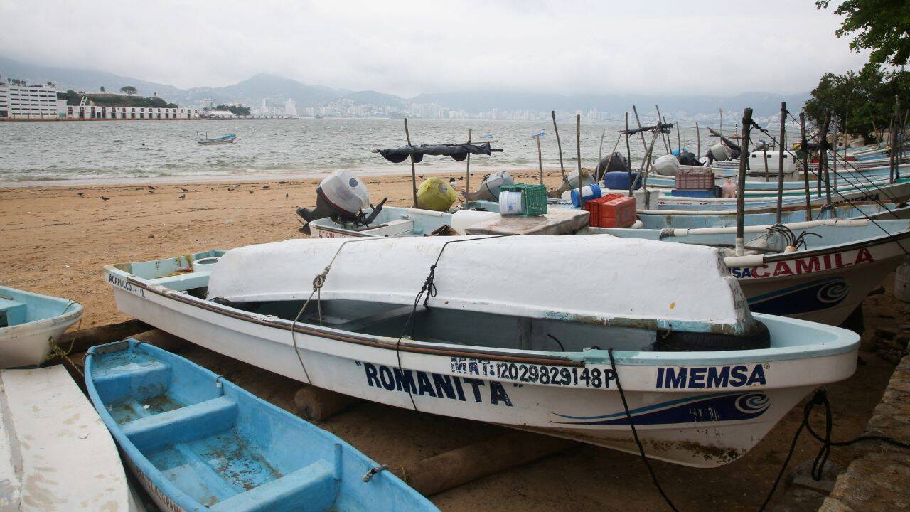
Standard hurricane dispatches treat a Category 3 classification as an automatic proxy for coastal devastation, yet the operational reality along Mexico's Pacific coast depends on a nonlinear interaction between wind speed, forward motion, bathymetry, and inland terrain. When Hurricane Trudy reached Category 3 intensity in October 2026 with maximum sustained winds near 195 km/h (120 mph) while tracking northwest at roughly 9 km/h (6 mph) hundreds of kilometers off southwestern and west-central Mexico, conventional wire-style reporting reduced a complex geophysical and infrastructure event to a headline speed threshold and a list of coastal advisories. Understanding what actually drives loss in such systems requires separating meteorological intensity from localized hazard exposure, distinguishing confirmed observations from educated hypotheses, and mapping how hazards cascade across ports, highways, and steep watersheds.
Deconstructing Conventional Storm Coverage
Typical breaking-news coverage of a major tropical cyclone follows a predictable template: announce the Saffir-Simpson category upgrade, cite the distance from one or two recognizable reference points such as Acapulco or Manzanillo, recite active warnings, and mention heavy rain. That structure informs readers that a dangerous storm exists, but it leaves out the causal chain that determines whether a community experiences minor tree damage, prolonged port paralysis, or fatal landslides. Don't miss our earlier article on this related article.
The first analytical flaw in headline-driven reporting is treating sustained one-minute wind speed as a complete summary of destructive power. Kinetic energy in wind scales with the square of velocity, while structural and aerodynamic damage often accelerates nonlinearly once wind gusts cross material or building thresholds. Meanwhile, a storm moving slowly at around 9 km/h (6 mph) lingers over favorable waters or coastal corridors longer than a fast-moving cyclone, extending the window of heavy precipitation and prolonged wave action even if peak winds fluctuate.
The second flaw is conflating offshore peak intensity with onshore impact. A hurricane can reach Category 3 status several hundred kilometers offshore—such as roughly 420 km (260 miles) southwest of Acapulco and nearly 590 km (365 miles) south-southeast of Manzanillo—and subsequently encounter cooler upper-ocean water, vertical wind shear, dry air entrainment, or frictional interaction with rugged terrain before or near closest approach. Reporting the peak category without explaining the physical conditions governing intensification and decay creates a mismatch between expectations and realized hazards. If you want more about the context of this, The Washington Post offers an in-depth summary.
The third flaw is treating rainfall, storm surge, and wind as independent side notes rather than coupled subsystems. Along Mexico's Pacific states—including Michoacán, Colima, and Jalisco—steep coastal mountain ranges rise quickly from narrow littoral plains and rocky headlands. When moisture-laden cyclonic inflow impinges on elevated topography, orographic lift can concentrate rainfall totals into multi-inch bands and isolated peaks around 12 inches, turning moderate offshore winds into severe inland runoff and slope failure hazards.
Known Facts Versus Educated Hypotheses
Rigorous risk analysis requires separating verified meteorological and operational facts from educated hypotheses about broader climate drivers and downstream economic losses. Mixing the two weakens credibility and obscures where uncertainty actually lies.
Verified Observations and Operational Facts
- Intensity and Motion: Hurricane Trudy attained Category 3 major hurricane status on the Saffir-Simpson scale with maximum sustained winds near 195 km/h (120 mph) and a slow northwestward forward speed near 9 km/h (6 mph) during its October 2026 intensification phase off Mexico's Pacific coast.
- Geographic Positioning: At its Category 3 milestone, the cyclone was positioned roughly 420 km (260 miles) southwest of Acapulco and about 590 km (365 miles) south-southeast of Manzanillo, placing southwestern and west-central coastal sectors within its broader wind, swell, and rain envelope.
- Hydrological Threat Profile: Forecasts across western and southwestern coastal states—specifically highlighting Michoacán, Colima, and Jalisco—projected widespread multi-inch rainfall totals (commonly 4 to 8 inches, with isolated pockets near 12 inches) capable of triggering flash floods and mudslides on steep terrain.
- Sequential and Regional Context: Coverage during the same window noted adjacent tropical activity—including Tropical Storm Simon to the northwest and broader eastern Pacific cyclone activity—underscoring that coastal emergency systems rarely operate against a blank slate.
Educated Hypotheses Requiring Verification
- Large-Scale Climate Attribution: Analysts and outlets often link elevated eastern Pacific storm activity to large-scale oceanic-atmospheric modes such as El Niño. While warmer sea surface temperatures and altered shear patterns can support tropical cyclone formation or intensification in certain sub-basins, attributing any single storm's exact peak intensity or track to a seasonal climate pattern remains a probabilistic hypothesis rather than a deterministic proof.
- Rapid Intensification and Decay Trajectories: Estimating how long a storm holds Category 3 strength as it approaches the coast involves competing physical hypotheses: warm subsurface heat content favors maintenance or brief surges, whereas upwelling, shear, or proximity to rugged landmass favors weakening.
- Localized Infrastructure Disruption: Predicting exact durations of power outages, port delays, or road washouts before landfall or closest approach is an educated operational projection based on historical vulnerability rather than a guaranteed outcome, because exact rain cores and wind swaths shift with small track adjustments.
The Four Pillars of Pacific Coast Storm Exposure
To move beyond surface headlines, evaluate Hurricane Trudy and similar eastern Pacific systems through four structural pillars: Atmospheric-Oceanic Coupling, Topographic Amplification, Critical Corridor Fragility, and Warning-to-Action Latency.
Atmospheric-Oceanic Coupling
Tropical cyclones act as heat engines extracting enthalpy from warm ocean surfaces and expelling heat at high altitude. Three variables govern whether that engine scales up or stalls:
- Sea Surface and Subsurface Heat Content: High surface temperatures supply latent heat, while a deep warm layer resists cooling when strong winds churn colder water upward.
- Vertical Wind Shear: Strong differences in wind speed or direction between lower and upper levels tilt the cyclone vortex, ventilating its warm core and suppressing organization.
- Mid-Level Moisture: Dry air entrained into the circulation weakens convective updrafts, capping intensity even when surface waters are warm.
When Trudy reached Category 3 strength offshore, these factors aligned favorably enough to support major hurricane winds. Any subsequent weakening as the system tracked northwest illustrates how quickly shifts in shear, ocean heat, or entrainment can alter the hazard profile before coastal arrival.
Topographic Amplification
Unlike flat coastal plains where storm surge and wind-driven inundation dominate across wide horizontal expanses, much of Mexico's Pacific coast pairs narrow shorelines and bays with abrupt mountain relief. A slow-moving storm at around 9 km/h (6 mph) forces moist air against slopes over many hours.
Consider a practical example along the Michoacán, Colima, or Jalisco coast. A town sitting a few kilometers inland from a steep ridge may experience lower peak sustained winds than an exposed headland, yet still face acute danger if saturated soils give way on an upper slope and send debris flows down a canyon road. Treating wind category as the primary danger understates slope and riverine hazards in steep terrain.
Critical Corridor Fragility
Coastal economies along western Mexico depend on concentrated lifelines—deepwater ports such as Manzanillo, coastal highways, bridges crossing river valleys, agricultural zones, and tourism hubs. A single point of failure creates network effects far beyond the immediate impact zone.
If heavy rainfall washes out a mountain highway section or floods a low-lying bridge approach, freight and emergency vehicles face detours that multiply transit times across the entire regional supply chain. Similarly, rough swells and port closures halt vessel movements even when a storm's eye remains well offshore.
Warning-to-Action Latency
Meteorological precision only reduces harm if it compresses the gap between official advisories and protective decisions. Hurricane and tropical storm warnings along stretches from southwestern to west-central Mexico—such as zones spanning from near Colima toward Jalisco—signal that hazardous conditions are imminent or occurring.
Latency grows when households, operators, or local agencies wait for visual confirmation of severe weather—dark skies, heavy downpours, or rising surf—before securing vessels, halting hillside construction, or moving out of flood-prone arroyos. By the time visual cues peak on a slow-moving storm, runoff may already be surging.
Cause-and-Effect Chains Standard Coverage Misses
Connecting physical mechanisms to operational outcomes reveals three causal chains that routine storm reporting rarely spells out.
Slow Forward Speed Plus Steep Relief Equals Compound Runoff
A forward speed near 9 km/h (6 mph) extends rainfall duration over the same watershed. Early rain saturates upper soil layers and fills small channels; later rain—especially isolated totals near 12 inches—has nowhere to infiltrate. The resulting cause-and-effect chain runs from prolonged precipitation to soil saturation, rapid overland flow, riverine cresting, and landslides or mudflows along steep inclines.
Offshore Swell Precedes Peak Wind and Rain
Long-period ocean swells propagate outward from a major hurricane faster and farther than the storm core itself. Coastal marinas, beaches, and low-lying piers can experience hazardous surf and coastal erosion well before peak winds or heaviest rain bands arrive—or even if the core weakens or remains offshore. Assuming danger scales strictly with local wind speed leads people to underestimate early ocean hazards.
Sequential Storms Degrade Baseline Resilience
When a region faces consecutive or closely spaced systems in an active Pacific season—such as Tropical Storm Simon preceding or operating near Trudy—pre-existing conditions change. Earlier rain can leave soils damp, river levels elevated, and drainage culverts partially obstructed, so a second storm of equal or even lower intensity produces disproportionate flooding and road closures.
Tactical Decision Framework for Coastal Operations
Whether managing a logistics operation, a coastal facility, or household preparedness during a major Pacific storm event, decisions should follow a disciplined sequence tied to hazard thresholds rather than headlines alone.
- Map Exposure by Hazard Type, Not Just Category: Separate wind exposure (open structures, cranes, signage), marine exposure (harbors, anchorages, low docks), and hydrological exposure (steep slopes, floodplains, low-water crossings). A Category 3 rating offshore does not eliminate inland flood risk if the storm slows or weakens near the coast.
- Anchor Triggers to Lead Times and Forecast Ranges: Use official warning perimeters and multi-day rainfall ranges (such as 4 to 8 inches with localized higher pockets) to set hard cutoffs for marine departures, supply staging, and site evacuations. Do not wait for peak intensity at the exact nearest point of approach.
- Audit Bottlenecks Before Inflow Begins: Identify single-road access routes, hillside retaining walls, backup power dependencies, and drainage chokepoints ahead of heavy rain. Once torrential rain starts in hilly terrain, field inspections become hazardous and slow.
- Shift From Wind Watch to Post-Rain Hazard Control: As a system moves past or weakens offshore, attention often relaxes prematurely. Maintain vigilance for delayed river crests, saturated slope failures, and slick or damaged roadways after the strongest winds subside.
Limitations and Analytical Boundaries
No analytical framework eliminates forecast uncertainty. Tropical cyclone intensity and track forecasts carry inherent error margins because small variations in convective organization, shear, or ocean structure can shift outcomes substantially over 24 to 72 hours. Localized rainfall maxima—such as isolated 12-inch pockets—are notoriously difficult to pinpoint hours in advance over complex mountain topography.
Furthermore, pre-storm preparedness cannot prevent every disruption. Extreme hydrological events can overwhelm engineered drainage regardless of planning, and balancing economic continuity against safety always involves trade-offs: shutting down operations too early carries avoidable commercial cost, while acting too late magnifies physical risk and recovery expense.
Strategic Recommendation
Treat every major eastern Pacific hurricane approaching Mexico's coast as a compound water-and-corridor event rather than a pure wind test, and pre-position contingency routing and drainage readiness around slow-moving rainfall tracks well before offshore peak winds make headlines.


