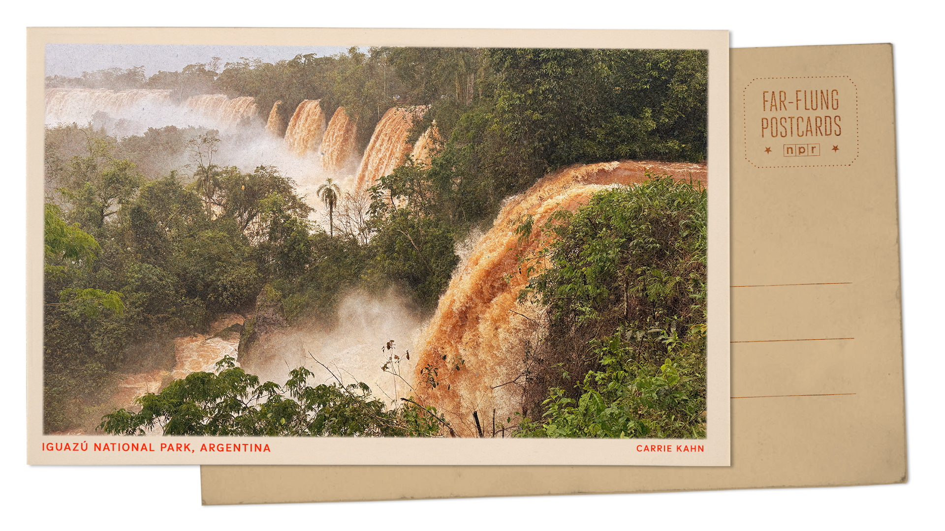
Standing on the walkways above the Iguazu Falls along the Brazil-Argentina border, when the cataracts roar at near-record volumes, the spectacle feels like pure triumph. Yet those surging sheets of white water tell a far more complicated story than any postcard implies. High flow rates along the Iguazu River stem from heavy upstream rainfall and shifting regional weather patterns, creating dramatic visual power while simultaneously forcing park authorities to close lower trails, restrict boat routes, and manage sudden erosion risks. What looks like effortless natural abundance is actually a volatile hydrological swing between drought and flood.
I have spent decades covering border economies, infrastructure strain, and tourism booms across South America, and I have learned not to confuse a photogenic peak with long-term stability. Travel writers love a roaring waterfall. Hydrologists and local operators look at the gauge readings, the sediment load, and the bridge closures that follow a sudden spike.
What Near-Record Flows Actually Mean on the Ground
Most casual visitors assume more water automatically makes a waterfall better. Sometimes it does. Sometimes it turns a scenic overlook into a mist-choked wall where you cannot see five feet past the railing.
Along the Iguazu Falls, average flow rates hover around a baseline that already dwarfs many famous cascades, while major rain events in the upper basin can push discharge multiples higher in a matter of days. When the river swells toward near-record levels, the Devil's Throat and surrounding cataracts lose their distinct, individual curtains and merge into a thunderous, continuous sheet. Spray rises high above the basalt rim, soaking boardwalks and turning clear afternoon light into a dense, cool haze.
That raw volume has a direct operational cost. Park rangers on both the Brazilian side in Foz do Iguaçu and the Argentine side in Puerto Iguazú routinely close catwalks that sit too close to the churning river when water levels rise past safe thresholds. A walkway built to withstand normal spray and occasional swells cannot stay open when thousands of cubic meters per second are slamming against the gorge walls below.
- Closed lower circuits: Flooded or spray-lashed trails near the base of the falls frequently shut down during high-water surges to protect visitors from slick surfaces and falling debris.
- Suspended boat excursions: Rigid-hull inflatable tours that normally push right up to the edge of the mist are halted when river currents become too turbulent or unpredictable.
- Erosion and bank stress: High-velocity water strips soil, undercuts vegetation along the riverbanks, and moves larger boulders through the canyon.
Tourists who fly in expecting to walk every trail and take every boat ride often run straight into those closures. A surge is thrilling from an upper balcony. It is frustrating if your itinerary depends on a boat launch that the harbor master just shut down.
The Weather Engine Behind the Surge
Water does not appear out of nowhere at the Brazil-Argentina border. What visitors see at the cliff edge is the downstream expression of weather systems that form hundreds of miles inland across southern Brazil and the broader Paraná River basin.
Heavy, concentrated rain over the upper Iguazu catchment acts like a funnel. Because much of the surrounding plateau has been altered over the past century by agriculture, road networks, and urban expansion, rainfall runoff can move through tributaries quickly rather than soaking slowly into undisturbed forest floor. When a stubborn rain system parks over the headwaters, the river rises fast, sending a pulse of brown, sediment-heavy water toward the border escarpment.
A record-setting surge at the falls is rarely a sign of a calm, steady climate. More often, it is the visible aftermath of extreme upstream rain colliding with a landscape that sheds water rapidly.
Climate variability makes these swings sharper. Periods of prolonged dryness can leave the river looking subdued and manageable, followed months later by intense downpours that push discharge toward historic highs. Over the years, watchers of the region have seen dramatic whiplash between low-water stretches that expose more rock and high-water episodes that test every piece of park infrastructure.
Consider a hypothetical scenario to see how quickly conditions can flip. Imagine a tourist agency in São Paulo or Buenos Aires books three months of peak-season packages based on calm river forecasts, only for a multi-day storm front over Paraná state to double river discharge in forty-eight hours. Walkways close, boats tie up, and guides have to improvise inland excursions while keeping clients calm. In real life, operators deal with variations of that exact squeeze every wet cycle.
Two Countries, One Gorge, Different Realities
The Brazil-Argentina border at Iguazu is one of the most distinctive geopolitical settings in South America. Two nations share a natural wonder, yet each side offers a different angle, a different management style, and a different economic footprint.
On the Brazilian side, the park layout favors sweeping panoramic views across the canyon toward the Argentine cataracts, with a streamlined path that lets travelers take in the grand scale quickly. On the Argentine side, extensive trail networks wind closer to individual falls and islands, giving visitors an immersive, up-close sense of scale when the paths are open.
| Feature | Brazilian Side | Argentine Side |
|---|---|---|
| Primary Viewing Angle | Broad panoramic overlooks across the gorge | Close-up trails and walkways near individual falls |
| High-Water Impact | Heavy mist and selected lower deck closures | Frequent trail and island access closures near surging water |
| Cross-Border Friction | Customs and bridge traffic between Foz do Iguaçu and Puerto Iguazú | Customs and bridge traffic plus internal park transit logistics |
| Visitor Pace | Compact, high-efficiency sightseeing loop | Longer, multi-zone exploration across forest and river paths |
Crossing between the two sides sounds simple on a map. In practice, border formalities, bridge congestion over the Iguazu River, and shifting local schedules can eat up half a day. When heavy rains hit, traffic slows further and plans built around tight cross-border transfers start to fray.
There is also an overlooked tension between conservation and mass tourism. National parks exist to protect ecosystems, yet millions of visitors generate the revenue and political attention that keep those ecosystems funded. High-water events expose how fragile that balance is: nature sets the terms, and human timetables have to bend.
The Overlooked Cost of Hydropower and Basin Management
When people talk about water levels along the Brazil-Argentina border, they usually focus on rain and waterfalls. They rarely spend enough time looking at upstream dams and water management across the broader river network.
The Iguazu River feeds into the Paraná River just downstream of the falls, near the point where Brazil, Argentina, and Paraguay meet. Upstream and nearby along this river system sit massive hydroelectric installations—most famously Itaipu, as well as upstream reservoirs on the Iguazu itself—that regulate water for power generation and grid stability.
Reservoir operations and natural runoff interact in complex ways. During extreme rain events, dam operators must manage water levels carefully to protect infrastructure and balance power generation, while natural tributaries below or between facilities continue to pour runoff directly into the channel. You cannot separate the romance of a free-falling cataract from the engineering reality of a heavily managed river basin.
Hydrological volatility affects more than sightseeing. High water carries branches, silt, and debris that wear down equipment and complicate maintenance, while low water raises concerns about reservoir storage and regional power supply. Anyone analyzing the region purely through a tourism lens misses half the picture.
How to Plan When the River Is Running High
If you are heading to the Iguazu Falls during or right after a period of heavy rain, treat near-record flow as a dynamic condition rather than a static guarantee. Check official park status updates the morning you go, not three weeks earlier.
Pack for real wet weather, not a light sprinkle. Even if rain is not falling directly over the viewpoints, high-volume cataracts generate dense, wind-driven spray that will soak cameras, phones, and jackets in minutes. Waterproof gear and dry bags are practical necessities, not optional extras.
- Build buffer days: Leave slack in your schedule in case a storm system delays flights, slows border crossings, or forces temporary closures on specific trails.
- Keep expectations flexible: If a lower walkway or boat tour is closed due to high water, pivot to upper viewpoints and forest trails rather than forcing a plan that no longer fits river conditions.
- Verify cross-border timing: If you plan to visit both the Brazilian and Argentine sides, allow extra time for immigration checks and bridge traffic, especially on weekends and holidays.
A surging waterfall is unforgettable precisely because you cannot domesticate it. Watch the water, respect the closures, and remember that the same torrential force thrilling you from the overlook is reshaping the canyon beneath your feet.


