Meteorology has a blind spot, and it is measured in depth. While multi-billion-dollar satellites orbit thousands of miles above the earth, staring down at swirling cloud tops with unblinking digital eyes, the actual engine room of a hurricane remains stubbornly opaque. Hurricanes do not run on clouds. They run on heat stored in the upper layers of the ocean. When a storm passes over a pocket of warm water, it drinks deeply, intensifying from a manageable gale into a catastrophic land-falling monster in a matter of hours. Traditional data collection relies on stationary moored buoys, expensive research vessels, and daring hurricane hunter aircraft that punch through the eye wall at high altitudes. These tools leave massive blind spots across the open ocean, particularly in remote migration corridors where storms gather their strength before striking populated coastlines.
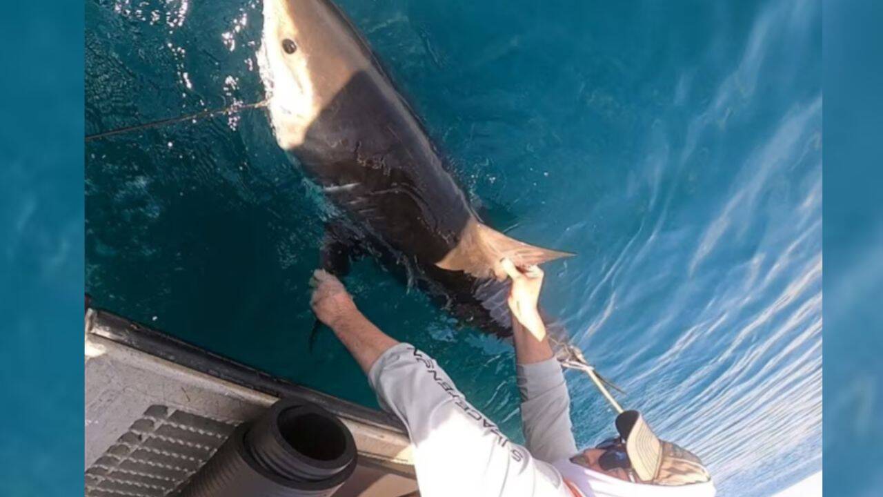
Enter an unconventional fleet of atmospheric and oceanographic sampling units: marine predators. By outfitting apex predators with acoustic and satellite-linked sensor packages, researchers are rewriting the playbook for hurricane forecasting. This strategy turns wild animals into autonomous data-gathering nodes, closing the gap between surface observations and deep-water thermal profiling. For a different view, consider: this related article.
The Physics of Rapid Intensification
To understand why traditional forecasting fails so often during rapid intensification events, look at what happens beneath the surface. A hurricane is fundamentally a heat engine. It sucks thermal energy from the sea surface and converts it into kinetic wind energy. When surface waters are warm and extend deep into the water column, a passing storm cannot easily churn up cooler water from below to cool itself off. The storm feeds without interruption.
Meteorologists call this the ocean heat content. Measuring it requires dropping expendable bathythermographs from airplanes or maintaining a network of deep-sea Argo floats. But buoys break loose during heavy seas, ships avoid the war zones that hurricanes create, and Argo floats drift passively rather than targeting critical storm tracks. Similar coverage regarding this has been published by The Next Web.
Marine predators solve this geographic and logistical failure. Species like tiger sharks, bull sharks, and great whites swim thousands of miles across tropical and subtropical basins. They routinely dive to depths of several hundred meters, operating precisely within the thermal layer that feeds major storms. As these animals move through the water column, their dorsal-mounted tags record temperature, salinity, and depth. When the shark breaks the surface to breathe or log its position, that telemetry fires back to orbiting satellites.
The data stream is dense, continuous, and gathered precisely where traditional oceanography cannot afford to maintain a permanent physical presence.
Tracking the Invisible Thermocline
Critics often raise ethical and practical objections to tagging marine wildlife for scientific telemetry. Animal welfare organizations worry about drag, stress, and behavioral modification caused by hardware bolted onto a wild creature. These are legitimate concerns that demand rigorous oversight.
However, modern tag engineering has evolved far beyond the crude, heavy transmitters of the past. Today's packages are streamlined, neutrally buoyant, and attached to the high-density cartilage of the first dorsal fin. This area lacks nerve endings, meaning the application causes no chronic pain, much like getting a piercing on an earlobe. The tags are programmed to detach automatically after a set period, corroding harmlessly or falling away during the animal's natural molt or skin shedding cycle.
The biological cost is minuscule compared to the ecological and human devastation wrought by unpredicted Category 5 hurricanes. When a storm like Hurricane Otis strikes a coastline with virtually no warning, the human toll is catastrophic. Better ocean profiling directly saves lives by giving emergency management agencies the precise data needed to order timely evacuations.
The operational mechanics are surprisingly straightforward. A tagged shark patrolling the Gulf of Mexico or the Caribbean Sea logs profiles of the water column daily. As it descends into a warm-core eddy—a spinning pool of warm water that acts like rocket fuel for tropical cyclones—the tag records the exact depth and temperature gradient. This information feeds straight into numerical weather prediction models, such as the Hurricane Analysis and Forecast System.
Models that incorporate high-resolution subsurface data perform significantly better at predicting whether a storm will fizzle out or explode in intensity before landfall.
The Economics of Apex Sampling
Building, deploying, and maintaining a global network of deep-ocean instrumented buoys costs hundreds of millions of dollars. Saltwater corrodes electronics, marine growth fouls sensors, and severe weather destroys hardware with ruthless regularity. The maintenance budget alone is a bureaucratic nightmare for agencies like the National Oceanic and Atmospheric Administration.
Sharks maintain themselves. They hunt their own food, navigate complex thermal corridors by instinct, and operate in every corner of the global ocean without requiring diesel-guzzling research vessels to transport them.
Financially, leveraging natural migration patterns for scientific data acquisition represents a massive efficiency gain. The primary investment shifts from building expensive steel hulls and mooring lines to fabricating miniaturized, ultra-reliable sensor tags and analyzing the incoming data pipelines.
Yet, data assimilation remains a technical hurdle. Weather prediction models are notoriously rigid. They were built to ingest data from standardized sources like radiosondes, satellites, and fixed buoys. Integrating irregular, mobile telemetry from a swimming, diving animal requires complex algorithmic adjustments. A weather balloon travels predictably upward with the wind. A shark swims against the current, rests on a reef, or migrates across ocean basins at variable speeds.
Meteorologists must account for this behavioral noise to extract pure environmental signal. Machine learning models are increasingly deployed to clean and contextualize this incoming wildlife telemetry, separating a shark's active swimming velocity from actual ocean currents and thermal shifts.
Beyond the Hurricane Corridor
The implications of biological oceanography extend far beyond Atlantic hurricane season. As global sea surface temperatures rise due to climate change, tropical storm belts are expanding poleward. Regions that historically experienced only mild seasonal squalls are now facing severe tropical systems.
Governments in these newly vulnerable zones lack the historical data infrastructure of the Gulf Coast or the Caribbean. They cannot afford massive arrays of deep-water monitoring buoys. Deploying sensor tags on regionally abundant shark populations offers a cost-effective alternative for baseline data collection.
Consider the western Pacific or the Indian Ocean, where fisheries overlap heavily with major shark habitats. Commercial longliners and artisanal fishers often interact with these tagged animals. Collaborative frameworks are emerging where fishing fleets assist researchers by reporting recaptured tags or downloading data payloads locally via short-range Bluetooth before releasing the animals back into the wild unharmed.
This creates an unexpected alliance between conservationists, meteorologists, and commercial fisheries. For decades, these groups have been at war over overfishing and habitat destruction. Tying the preservation of apex predators to public safety and severe weather forecasting shifts the conservation narrative from abstract ecological altruism to immediate, pragmatic self-interest. A healthy shark population is no longer just a conservation goal; it is a critical component of coastal resilience infrastructure.
The ocean remains the last truly wild frontier on earth, covering over seventy percent of the planet's surface while hiding its deepest thermodynamic secrets beneath a deceptively calm skin. For generations, humanity tried to conquer this expanse with brute force, anchoring heavy steel and expensive electronics against the fury of the open sea. That approach has hit its economic and practical limits.
By looking to the ancient, evolved navigation instincts of marine predators, science has found a quieter, smarter way to listen to the sea. The next time a massive storm gathers its strength over the warm blue depths, the warning signs will not just come from the sky above. They will rise from the silent, purposeful movements of a shark cutting through the thermocline below.