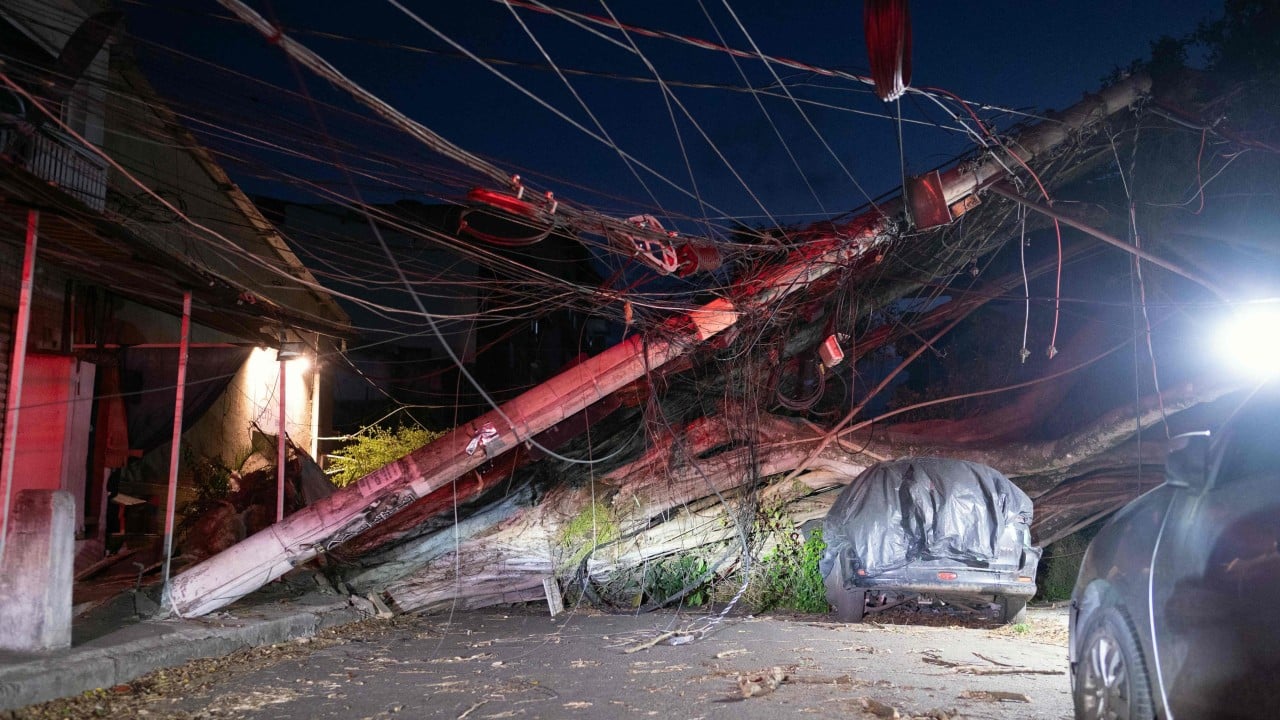
When freak weather hits densely populated urban centers, the disruption is immediate and unforgiving. Five people lost their lives when severe, hurricane-force gusts slammed into southeastern Brazil, turning normal afternoon commutes into scenes of absolute panic across Rio de Janeiro and parts of Sao Paulo state.
If you are wondering how a sudden squall can cripple two of South America's biggest economic hubs in minutes, the answer lies in the volatile combination of an approaching oceanic cold front colliding with unseasonably hot, sunny weather. This meteorological setup generated winds reaching up to 100 kilometers per hour in Rio and staggering speeds of 111 kilometers per hour in Santos, Sao Paulo.
Let's look at what actually happened on the ground, why urban infrastructure buckled so fast, and what this means for emergency preparedness moving forward.
The Anatomy of the Sudden Squall
Most residents in Rio were caught completely off guard. It started as a typical hot day. People crowded the famous sands of Copacabana and Ipanema. Within minutes, intense wind whips blew sand aggressively, tossing beach umbrellas and sending sunbathers scattering.
The transition from calm sunshine to destructive gales happened right before the evening rush hour. That timing amplified the disaster.
- Wind Speeds: Gusts peaked near 100 km/h in Rio and hit 111 km/h in coastal Sao Paulo areas like Santos.
- Transport Paralysis: Rio's vital subway lines ground to a complete halt, stranding tens of thousands of commuters.
- Airport Disruptions: Major aviation hubs, including Rio's downtown Santos Dumont Airport, suspended operations entirely for hours.
The fire department reported over 90 fallen trees across Rio alone. In the middle-class neighborhood of Botafogo, massive trees crashed down around city infrastructure, missing local businesses by inches.
Why the Human Toll Was Severe
Nature doesn't care about city planning. When structural integrity fails under extreme pressure, tragedies follow.
Authorities confirmed that five people died across the affected region. Two individuals lost their lives in Rio de Janeiro when a heavy wall collapsed under the wind load. In Santos, a homeless person was killed instantly by a falling tree. Another fisherman went missing off the coast of Tarituba, highlighting the severe marine hazards triggered by the sudden swell.
City operations centers pointed directly to an advancing oceanic cold front meeting warm continental air masses. This atmospheric clash creates localized micro-bursts and extreme wind shear that standard urban infrastructure struggles to absorb. Power grids failed across multiple neighborhoods, plunging homes and businesses into sudden blackouts before repair crews could safely deploy.
Infrastructure Realities in South American Megacities
Megacities like Rio and Sao Paulo face unique vulnerabilities when extreme weather events strike. Older urban zones feature mature, heavy tree canopies that provide essential shade during hot months, but become high-risk projectiles when 100 km/h winds hit unmanaged root systems.
Public transit dependency compounds the issue. When subway power fails or overhead debris blocks tracks, millions of people have few alternative ways to escape vulnerable downtown corridors. Municipal authorities often face heavy criticism for public transport standstills, but the reality of running underground and surface transit lines during widespread electrical failures presents an immense safety bottleneck.
If you live in or travel to coastal South America during seasonal transition periods, staying glued to local civil defense alerts is non-negotiable. Weather patterns are shifting, and historical norms for regional storms no longer apply.
Monitor local municipal operations channels, keep emergency battery backups ready, and avoid coastal transit routes the moment severe cold fronts are forecast to collide with hot inland air.