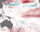
Stop holding your breath for the 2027 super climate apocalypse.
Every time a long-range climate model spits out a bright red spike in Pacific sea surface temperatures, a familiar circus rolls into town. The headlines write themselves: "Super El Niño looming," "Hottest year on record incoming," and "Scientists wait with bated breath." Meteorological agencies issue breathless press releases, media outlets copy-paste the dread, and the public is treated to another round of climate anxiety.
This is lazy science, driven by a thirst for clicks and institutional funding.
The Bureau of Meteorology (BoM) and other global forecasting bodies are currently pointing to early modeling to warn us that 2027 will be a scorched-earth year of unprecedented heat. But anyone who has spent decades analyzing climate modeling outputs knows the dirty secret of long-range forecasting: making definitive claims about an El Niño event more than nine months in advance is the meteorological equivalent of throwing darts at a board while blindfolded.
The climate is warming; that is an established thermodynamic reality. But the obsession with predicting a "Super El Niño" a year out misses the actual physics of how our oceans distribute heat. It conflates a temporary atmospheric burp with structural climate change, relying on models that are notoriously fragile when looking too far down the road.
Let us dismantle the panic and look at the actual mechanics of the Pacific Ocean.
The Spring Predictability Barrier is Undefeated
To understand why the 2027 panic is premature, you have to understand the fundamental limitation of meteorological forecasting: the Spring Predictability Barrier (SPB).
In the Southern Hemisphere autumn (Northern Hemisphere spring), the tropical Pacific atmospheric-oceanic system enters a state of highly volatile equilibrium. During this window, the coupling between the wind patterns and the ocean surface is incredibly weak. Because the system is so quiet, even minor, localized wind shifts can completely redirect the trajectory of the El Niño-Southern Oscillation (ENSO).
Here is how the timeline actually works, compared to how the media portrays it:
| Phase | Media Narrative | Physical Reality |
|---|---|---|
| 12-18 Months Out | "Super El Niño confirmed, prepare for record-shattering heat." | Raw ensemble models show a wide spread of possibilities. Skill levels are near zero. |
| Spring Barrier (March-May) | "Scientists watch with bated breath as temperatures rise." | The ocean-atmosphere coupling is weak. Localized wind gusts can completely kill the developing event. |
| June-August | "The heatwave is here, the models were right." | Real-time ocean observations (Kelvin waves, trade wind weakening) finally show if an event is actually forming. |
| September-December | "Peak catastrophe." | The event reaches its maximum intensity. Only now can we accurately measure its strength. |
I have watched climate agencies fall into this trap repeatedly. Remember 2014? The exact same alarmist rhetoric dominated the news cycle. Models predicted a "monster" El Niño that would dwarf the historic 1997-1998 event. Agencies warned of global agricultural collapse and unprecedented global temperatures.
What actually happened? The trade winds refused to cooperate. The atmospheric coupling never materialized, and the "monster" event fizzled into a weak, barely noticeable blip. The actual Super El Niño did not arrive until late 2015.
Making a definitive call for 2027 in mid-2026 ignores the reality that the ocean has to cross the 2027 spring barrier first. Until it does, any "Super" forecast is nothing more than statistical noise amplified by an eager PR department.
The Thermodynamics Fallacy: El Niño Does Not Create Heat
The loudest warning of the 2027 forecast is that it will be the "hottest year on record." This statement reveals a profound misunderstanding of planetary thermodynamics.
An El Niño does not generate new heat. It does not add thermal energy to the Earth system. Instead, it is a massive redistributor of existing energy.
Under normal conditions, strong trade winds blow from east to west across the equatorial Pacific. This piles up warm water in the western Pacific (the West Pacific Warm Pool) and forces cold, nutrient-rich water to upwell along the coast of South America. This is a massive heat storage mechanism. The ocean is effectively hiding heat in its deeper layers, keeping the global atmosphere relatively cool.
During an El Niño, those trade winds weaken or reverse. The warm water piled up in the west sloshes back eastward in a series of subsurface waves called Kelvin waves. This spreads a thin layer of hot water across thousands of miles of the central and eastern Pacific.
The Atmospheric Burp: When warm water covers a larger surface area of the ocean, it releases massive amounts of heat and moisture into the atmosphere. The global mean surface temperature (GMST) spikes.
But here is the catch: while the atmosphere gets warmer, the ocean is actually cooling down. It is releasing its stored thermal energy into space.
By obsessing over whether 2027 will be the "hottest year," we are staring at the thermometer while ignoring the furnace. The metric we should be tracking is Ocean Heat Content (OHC), particularly in the upper 2,000 meters. OHC has been rising steadily and relentlessly, regardless of whether we are in an El Niño or a La Niña phase.
Focusing on the surface temperature spike of an El Niño year is like looking at a person with a fever and assuming they are suddenly producing more energy, rather than realizing their body is simply shifting its internal heat to the skin. The panic over 2027 atmospheric temperatures is a distraction from the structural, slow-burn warming of the deep ocean.
Modoki vs. Canonical: The Critical Detail Left Out of the Panic
Even if we assume a strong warm event occurs in 2027, treating all El Niños as a single, uniform monster is a critical error. The meteorological community has known for years that spatial distribution matters far more than peak temperature anomalies in a single region.
Specifically, we must differentiate between two distinct flavors of warming:
1. Canonical (Eastern Pacific) El Niño
This is the classic event. Warming is centered in the eastern equatorial Pacific, near South America (the Niño 1+2 and Niño 3 regions). It causes massive disruption to the jet stream, leading to severe droughts in Australia and Indonesia, and torrential rains in Peru and California.
2. Modoki (Central Pacific) El Niño
"Modoki" is a Japanese term meaning "similar but different." In a Modoki event, the warming is concentrated in the central Pacific (the Niño 4 region), while the eastern and western Pacific remain cool.
The climate impacts of a Modoki event are vastly different—and often completely opposite—to those of a canonical event. For instance, while a classic El Niño brings widespread drought to eastern Australia, a Modoki event can sometimes bring average or even above-average rainfall to parts of the continent, depending on how it interacts with the Indian Ocean.
Yet, when agencies like the BoM scream about 2027, they look at bulk temperature anomalies in the Niño 3.4 region. They rarely explain that if the warming manifests as a Modoki event, the catastrophic droughts and fires predicted for Australia and Southeast Asia might not happen at all. They present a highly nuanced, spatially variable physical phenomenon as a binary "hot/cold" switch.
Why Climate Agencies Hypocritically Hype the Outliers
Why do otherwise reputable scientific organizations publish highly speculative, long-range forecasts with such certainty?
The answer is institutional survival.
Modern scientific funding is a battleground. Agencies like the BoM, NOAA, and the ECMWF are constantly fighting for government allocations, research grants, and public relevance. A calm, scientifically precise statement like "There is a 30% chance of a moderate warm anomaly in late 2027, subject to significant spring predictability barrier limitations" does not get headlines. It does not get discussed in parliament or congress. It does not secure funding for the next generation of supercomputers.
But a headline shouting "Super El Niño could make 2027 the hottest year on record" gets immediate attention. It positions the agency as the essential shield protecting the nation from impending disaster.
There is also a psychological bias at play: loss aversion. If an agency predicts a quiet year and a massive El Niño hits, they are roasted for failing to warn the public. If they predict a massive El Niño and it fizzles out, they can easily blame the chaotic nature of the atmosphere, claim they were "preparing for the worst-case scenario," and escape accountability.
This asymmetry incentivizes continuous, systemic over-prediction of extreme events. It is a classic cry-wolf scenario. By the time a truly catastrophic, rapidly developing event actually occurs, the public and policymakers have developed fatigue from years of unfulfilled "Super" warnings.
What the Real Data is Telling Us to Watch
If you want to understand what 2027 will actually look like, turn off the news and stop looking at raw surface temperature models. Instead, track the real physical precursors that govern the Pacific.
If a true, historically significant El Niño is going to materialize, it will require specific physical building blocks to fall into place. Watch these three indicators:
- Westerly Wind Bursts (WWBs): Keep an eye on the western Pacific, near Indonesia. We need to see sustained, powerful bursts of winds blowing from west to east. These bursts are the triggers that push the warm pool eastward. Without them, the warm water stays put.
- Subsurface Temperature Anomalies: Look at the temperature of the water 100 to 200 meters below the surface in the central Pacific. If there is no massive reservoir of subsurface heat waiting to be tapped, any surface warming will be short-lived and shallow.
- The Trade Wind Strength: Watch the trade winds along the equator. If they remain strong or even average, they will continuously fight against any eastward warm water migration.
If these three factors are not aligned by late 2026, then any talk of a "Super El Niño" in 2027 is pure fiction.
The climate crisis is a structural, long-term challenge that requires sober analysis and systemic adaptation. We do not need sensationalized, long-range scare campaigns that rely on fragile models. Stop waiting for the 2027 apocalypse with bated breath. The ocean is far more complex, stubborn, and unpredictable than a sensationalized press release will ever admit.